Why Water Reaches a Montclair Basement From Uphill
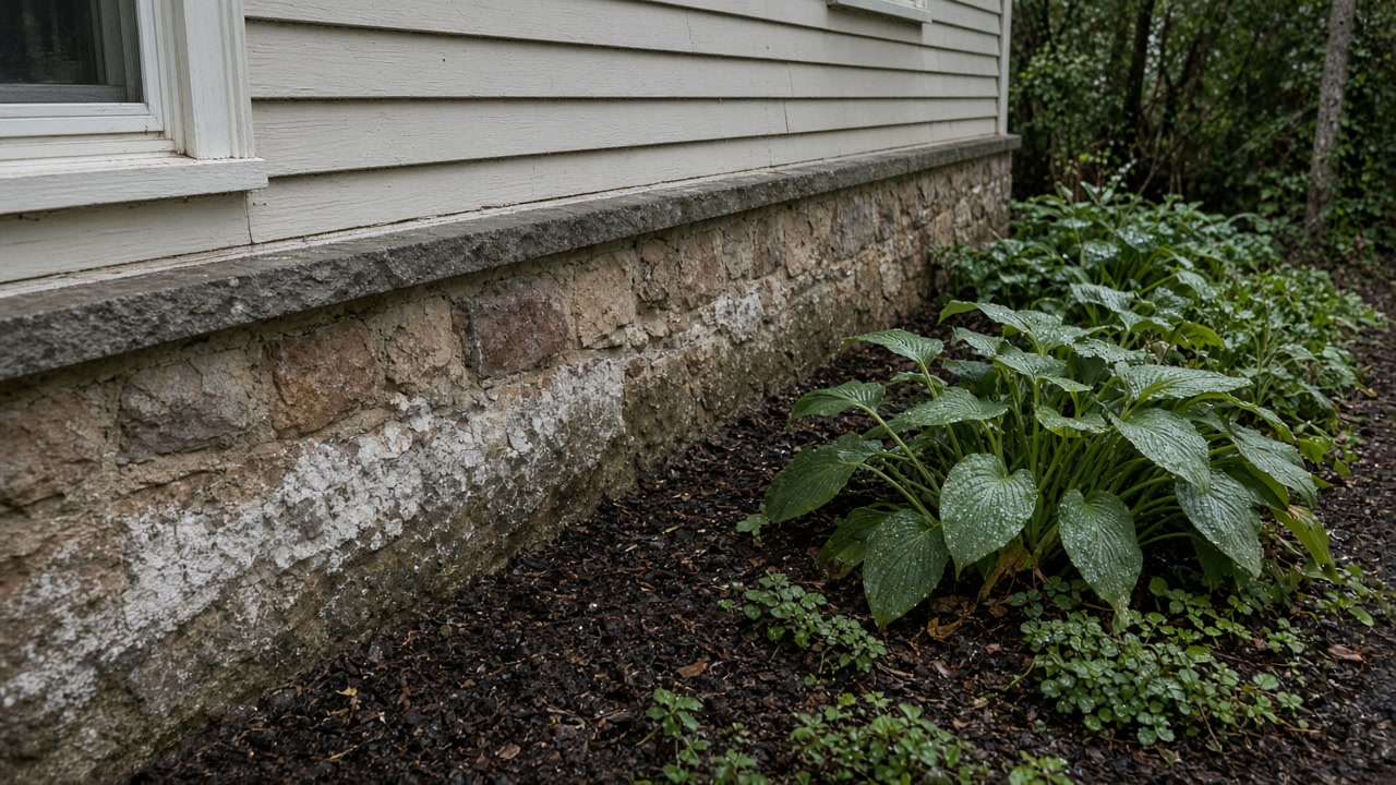
Because on this hillside the water arrives sideways rather than from below. The federal soil surveys for the ground under these towns record a water table perched above the basalt from November to May, seeping out at slope breaks, and it reaches foundations that in the median Montclair case were poured in 1938 with no exterior damp proofing, where a later finished wall now holds the damp against the masonry and hides it.
Already know you need someone out? Call (315) 640-3590, answered 24/7.
How to work out where the water is getting in
Decide which way the ground falls
You, with a walk around the blockMontclair rises more than 450 feet from its eastern edge to the ridge. Your house is either receiving water from uphill or sending it downhill, and that decides which wall is the suspect.
Read the humidity before you read the wall
You, with a hygrometerThe EPA target is below 60 percent relative humidity, ideally 30 to 50. Above 60 in July with the windows open is a ventilation problem, not a foundation problem.
Look again in late winter
You, or an assessorThe county water table peaks in late winter and early spring and bottoms out in September or October, so a fall inspection sees the wall at the driest moment of its year.
Follow the water to the uphill side
An assessorThe USDA series description says lateral seepage is common at slope breaks. The stain inside is frequently downstream of the point where the water crossed the foundation.
Open the finished wall where the readings say to
An assessorFederal guidance puts the growth on the hidden face of drywall and inside the stud bay. A clean painted surface is not evidence about the cavity behind it.
Price the removal only after the source is named
A remediation contractorRemoval against a source that is still running is a job you pay for twice, once now and again in March.
On a slope the order matters. Every step above is done before anything is opened up, because the cheapest fix is always the one outside the wall.
Where the water comes from on a hillside like this one
Montclair steps down more than 450 feet inside 6.24 square miles, from about 639 feet on the First Watchung ridge on the western side to about 184 feet where the township meets Glen Ridge and Bloomfield. The USDA official series description for the Haledon soil, formed in coarse textured till made mainly of basalt, states the mechanism in plain language: these soils sit at the base of steeper sloping uplands and in shallow drainageways, a perched high water table comes within 30 centimeters of the surface in late winter and early spring, and lateral seepage is common, particularly at slope breaks. On the higher, steeper ground the Holyoke series gives only 25 to 50 centimeters, about 10 to 20 inches, of soil over basalt bedrock, with medium to very rapid surface runoff. Rain that lands two streets above you has almost nowhere to soak away, so it travels along the top of the rock and comes out where the slope changes. That is usually the uphill side of somebody's foundation.
The wet half of the year runs from November to May
The Boonton series, the till upland soil of northeastern New Jersey and the one under much of this urbanized ground, records a perched water table at 46 to 91 centimeters, roughly 18 to 36 inches, from November to May in most years. Eighteen to 36 inches is the height of a basement wall, not the depth below a footing. The Essex County hazard plan describes the same cycle from the county side: water tables are usually highest in late winter and into early spring, water may pond for variable periods then, and from May or June the table drops to its lowest levels in September and October. Nothing has to break for a basement to change character between those two dates. It also means the inspection most people rely on, the one done during a fall closing, looks at the wall at the driest moment of its year. If somebody tells you a basement is dry, the useful question is what it looks like in March.
What a house built in 1938 does not have
The American Community Survey puts the median year built for a Montclair housing unit at 1938. The national median is 1980 and the Essex County median is 1958, so the typical house here is a generation older than the county around it, and 9,809 of the township's 16,521 units, 59.4 percent, went up in 1939 or earlier. A foundation of that age was not built with an exterior membrane, a perimeter drain or a sub slab vapor barrier, because none of those were standard practice. Treat their absence as the normal condition rather than as something a previous owner took away. Then the weather works on what is there. The 1991 to 2020 normals for Essex County Airport in Caldwell give 114.3 nights a year at or below freezing against only 19.3 days that stay there, which implies roughly 95 crossings of the freezing point and back every year. That is what opens mortar joints, parging and slab cracks over eighty winters.
Some of these basements are wet with no leak at all
Newark Liberty is the nearest station publishing hourly climate normals, and across July and August 1,468 of its 1,488 normal hourly dew point values sit at 60 degrees Fahrenheit or above. The July normal dew point averages 63.3 degrees and never drops below 60.6 at any hour of any day in the month. Any surface colder than about 61 degrees pulls water straight out of that air, and a masonry wall below grade sits in the fifties all summer. So a basement can run wet through July and August with no crack, no storm and no plumbing fault. The New Jersey Department of Health lists condensation inside walls due to poor insulation as a source of excess moisture in its own right, alongside leaks, roofs and flooding, and says plainly that no moisture means no mold growth. The EPA attaches a number to it: keep indoor relative humidity below 60 percent, ideally between 30 and 50. Buy a hygrometer before you buy anything else.
Six brooks run through this township and most are invisible
The Montclair Engineering Bureau lists six named waterways with floodplains inside the township: Toneys Brook, Nishuane Brook, Crescent Brook, Yantacaw Brook, 3rd River, also called Pearl Brook, and Wigwam Brook. It puts 810 of the roughly 11,000 tax parcels, about 7.5 percent, inside one or more flood zones, most frequently along Toneys and Nishuane. It also names the cause: most of those flood zone properties sit in floodplains created by undersized road culverts or by encroachments into a natural floodway, systems sized for conditions of fifty years or more ago, with peak stream flows rising as development continued. None of this is visible from the street, and the mapped line is not the edge of the problem. Of Montclair's 301 paid federal flood insurance claims, 115 were on properties rated zone X, B or C, outside the Special Flood Hazard Area, and the township's own hazard annex says stormwater flooding is a repetitive issue including in areas outside the floodplain.
It is groundwater or storm runoff here, not sewage
This matters more than it sounds, because it decides what can be saved. The Essex County hazard mitigation plan states that combined sewer overflows exist in the county within the older Passaic Valley Sewerage Commission and Joint Meeting sewered areas, and that within the unconsolidated portion of Essex County there are no known combined sewer overflows. The suburban towns on and around this ridge are in that second group. The claim record agrees about where the water comes from: of the 301 paid flood insurance claims in Montclair, 156 are coded as accumulation of rainfall or snowmelt against only 90 for stream, river or lake overflow. So the default here is clean water arriving too fast, not contaminated water backing out of a shared pipe, and that usually means a shorter list of things that have to be thrown away. Montclair also runs its own Water Bureau and Sewer Utility, so a suspected service line or lateral is a township question rather than a regional one.
Why the finished wall is where damp becomes a mold job
Of the 265 Montclair flood insurance claims that record a basement type, 119 were on finished basements or enclosures. A finished basement is the thing that converts a damp wall into a remediation scope, because studs, batt insulation and drywall hold water against masonry that was built to breathe, and then hide it. Federal guidance says the same from the other direction: the EPA lists hidden mold on the back side of drywall, on wallpaper and paneling, above ceiling tiles, under carpet and pads, and on walls in cold corners behind furniture where condensation forms. The New Jersey Department of Health adds that molds may grow unnoticed above ceilings, behind walls, in attics, basements and crawl spaces, that drywall, ceiling tiles and wood framing all contain cellulose, and that growth on those materials can begin to break down studs and joists. A clean looking painted wall is not evidence about the cavity behind it.
Three things you can settle yourself this week
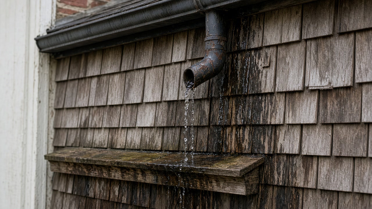
First, the humidity. If a hygrometer in the basement reads above 60 percent in July, close the windows and run a dehumidifier, and see what the number does over two weeks. If it comes down and stays down, you had a ventilation problem and you are finished. Second, the outside of the uphill wall. Downspouts discharging at the foundation, a path or patio that has settled back toward the house, and a blocked area drain are cheap to fix and they are upstream of everything expensive. Third, the calendar. Essex County Airport records a 49.05 inch annual precipitation normal with no month below 2.85 inches, so there is no dry season here for a wall to recover in, and a drainage fault that only shows in wet weather is in wet weather most weeks of the year. Take a photograph of the wall each month and you will know by spring whether the pattern is seasonal.
When it is worth having somebody look at it
If the humidity comes down and the wall dries, you do not need anyone. Bring somebody in when the damp stays after the dehumidifier has been running, when the stain returns in the same place every late winter, when you can smell it but cannot find it, or when a finished wall is going up against that masonry and you want the drainage decision made first. One thing to know before you call: New Jersey licenses and certifies nobody to do this work. The state Department of Health says so in the notice standing above the lists of mold companies it publishes, that there are no State certification programs for companies performing mold or general indoor air and environmental health services, and it adds that the Department does not endorse or qualify the work those companies provide. So appearing on a state list is not a credential, and nothing in state law stops the company that finds the water from selling you the removal. That is why we keep the assessment and the removal in different hands and put the findings in writing.
Sources used in this guide
USGS 3D Elevation Program values sampled on a 383 point grid inside the Montclair township boundary run from about 184 feet above sea level on the southern and eastern edges, where the township meets Glen Ridge and Bloomfield, to about 639 feet on the western side along the First Watchung ridge. That is a rise of more than 450 feet inside a township of 6.24 square miles of land.
Source: United States Geological Survey, 3D Elevation Program point query service, accessed 2026-09-21
The USDA official series description for the Haledon soil series, formed in coarse textured glacial till made primarily of basalt with red sandstone and shale, states that these soils sit at the base of steeper sloping uplands and in shallow drainageways, that a perched high water table is within 30 centimeters of the surface in late winter and early spring of most years and following periods of extended rainfall, and that lateral seepage is common, particularly at slope breaks.
Source: United States Department of Agriculture, Natural Resources Conservation Service, Official Series Description, accessed 2026-09-21
The USDA official series description for the Holyoke series, which occupies the higher and steeper bedrock controlled hills where the underlying rock is primarily basalt, gives a solum thickness and depth to bedrock of only 25 to 50 centimeters, about 10 to 20 inches, and classes the soils as well drained to somewhat excessively drained with medium to very rapid surface runoff.
Source: United States Department of Agriculture, Natural Resources Conservation Service, Official Series Description, accessed 2026-09-21
The USDA official series description for the Boonton series, the till upland soil of northeastern New Jersey formed over red to brown shale, sandstone, basalt and granitic gneiss, records a fragipan in which saturated hydraulic conductivity is low or very low, and a perched water table at a depth of 46 to 91 centimeters, roughly 18 to 36 inches, from November to May of most years. The description notes that most Boonton soils are in areas that have become highly urbanized.
Source: United States Department of Agriculture, Natural Resources Conservation Service, Official Series Description, accessed 2026-09-21
The Essex County hazard mitigation plan records the seasonal pattern of the county's water table: water tables are usually highest in the late winter and into early spring, water may pond or flood for variable periods during that time, and in May or June the table usually begins to drop to its lowest levels, which occur in September or October.
Source: Essex County Office of Emergency Management, 2025 Hazard Mitigation Plan Update, Volume I, accessed 2026-09-21
The USGS New Jersey Water Science Center describes the bedrock aquifers of this region as fracture systems rather than porous ground: water generally is present in weathered joint and fracture systems in the upper 200 or 300 feet, and below a depth of 500 feet fractures are fewer and smaller and water availability is reduced. Only in coarse grained sandstones is groundwater also present in intergranular pore spaces.
Source: United States Geological Survey, New Jersey Water Science Center, accessed 2026-09-21
The rock under the First Watchung Mountain ridge on Montclair's western side is the Orange Mountain Basalt, mapped by the USGS in Essex, Bergen, Passaic, Somerset, Union and Hunterdon counties as dark greenish gray to greenish black basalt of Lower Jurassic age. It is three stacked lava flows up to about 182 meters, roughly 597 feet, thick, and the map description records the water paths through it as structures rather than pores: widely spaced curvilinear joints in the lowest flow, columnar jointing in the middle flow, pillow and pahoehoe structures in the uppermost flow, with vesicular tops and bottoms to each layer.
Source: United States Geological Survey, State Geologic Map Compilation, after Drake and others, Bedrock Geologic Map of Northern New Jersey, accessed 2026-09-21
The American Community Survey puts the median year a Montclair township housing unit was built at 1938, which is 42 years older than the national median and 20 years older than the Essex County median. The value carries no margin of error because it sits at the bottom of the range the table reports.
Source: United States Census Bureau, American Community Survey 2020-2024 five year estimates, accessed 2026-09-21
Of Montclair township's 16,521 housing units, 9,809 were built in 1939 or earlier. That is 59.4 percent of the whole stock, and 73.9 percent of Montclair homes were built before 1960.
Source: United States Census Bureau, American Community Survey 2020-2024 five year estimates, accessed 2026-09-21
Under the 2020-2024 American Community Survey, the median year of construction is 1980 nationally, 1970 for New Jersey and 1958 for Essex County, and the share of housing units built in 1939 or earlier is 11.7 percent nationally, 17.4 percent in New Jersey and 29.1 percent in Essex County.
Source: United States Census Bureau, American Community Survey 2020-2024 five year estimates, accessed 2026-09-21
The 1991 to 2020 normals for Essex County Airport in Caldwell give 114.3 nights a year on which the minimum temperature falls to 32 degrees Fahrenheit or below, but only 19.3 days a year on which the maximum stays at or below 32. The difference implies roughly 95 days a year when the air crosses the freezing point and back again.
Source: National Oceanic and Atmospheric Administration, National Centers for Environmental Information, 1991-2020 Climate Normals, accessed 2026-09-21
At Essex County Airport in Caldwell, the closest first order station to the Watchung ridge itself, the 1991 to 2020 annual precipitation normal is 49.05 inches, spread evenly enough that no month falls below 2.85 inches and the July normal is 4.55 inches.
Source: National Oceanic and Atmospheric Administration, National Centers for Environmental Information, 1991-2020 Climate Normals, accessed 2026-09-21
Newark Liberty International Airport is the nearest station with hourly climate normals. Across July and August, 1,468 of its 1,488 normal hourly dew point values are 60 degrees Fahrenheit or above. The July normal dew point averages 63.3 degrees and does not drop below 60.6 degrees at any hour of any day in the month.
Source: National Oceanic and Atmospheric Administration, National Centers for Environmental Information, 1991-2020 Climate Normals, accessed 2026-09-21
The New Jersey Department of Health guidance booklet for residents lists the sources of excess moisture as plumbing leaks, leaking roofs or windows, high humidity, flooding, or condensation inside walls due to poor insulation, and states plainly that no moisture means no mold growth.
Source: New Jersey Department of Health, Consumer, Environmental and Occupational Health Service, accessed 2026-09-21
The EPA mold course states that indoor relative humidity should be kept below 60 percent and ideally between 30 and 50 percent, and lists high humidity at 60 percent relative humidity among the common moisture problems associated with mold.
Source: United States Environmental Protection Agency, Introduction to Mold and Mold Remediation, accessed 2026-09-21
The Montclair Engineering Bureau lists six named waterways with associated floodplains inside the township: Toneys Brook, Nishuane Brook, Crescent Brook, Yantacaw Brook, 3rd River, also known as Pearl Brook, and Wigwam Brook.
Source: Township of Montclair, Engineering Bureau, accessed 2026-09-21
The Montclair Engineering Bureau states that 810 of the roughly 11,000 tax parcels in Montclair, about 7.5 percent, lie within one or more flood zones, and that there are multiple areas of Special Flood Hazard in the township associated with various waterways, most frequently Toney's and Nishuane Brooks.
Source: Township of Montclair, Engineering Bureau, accessed 2026-09-21
The Montclair Engineering Bureau states that most of the township's flood zone properties are associated with floodplains resulting from undersized road culverts or encroachments into a natural floodway, that those systems accommodated conditions that existed fifty years or more ago, and that the cumulative effect of continued development has been a steady increase in peak stream flows and localized street flooding during major storms.
Source: Township of Montclair, Engineering Bureau, accessed 2026-09-21
Of Montclair's 301 paid federal flood insurance claims, 115 were on properties rated in zone X, B or C, that is outside the Special Flood Hazard Area, against 184 rated in zone A or AE inside it.
Source: Federal Emergency Management Agency, OpenFEMA FIMA NFIP Redacted Claims v2, accessed 2026-09-21
In its 2025 hazard mitigation annex, Montclair identifies that stormwater components in the township may be outdated and undersized and that stormwater flooding is a repetitive issue, including in areas outside the floodplain. The township also identifies that its ambulance unit building in the 1 percent floodplain has been flooded numerous times.
Source: Essex County Office of Emergency Management, 2025 Hazard Mitigation Plan Update, Volume II, municipal annexes, accessed 2026-09-21
The Essex County hazard mitigation plan states that combined sewer overflows exist in the county within the older Passaic Valley Sewerage Commission and Joint Meeting sewered areas, and that within the unconsolidated portion of Essex County there are no known combined sewer overflows.
Source: Essex County Office of Emergency Management, 2025 Hazard Mitigation Plan Update, Volume I, accessed 2026-09-21
Federal flood insurance records list 301 paid claims in Montclair totaling about $3.20 million. Of those, 156 are coded as accumulation of rainfall or snowmelt and only 90 as stream, river or lake overflow. The three costliest events are the remnants of Hurricane Ida in 2021 with 63 claims and about $1.63 million paid, Hurricane Irene in 2011 with 58 claims, and Hurricane Floyd in 1999 with 44 claims.
Source: Federal Emergency Management Agency, OpenFEMA FIMA NFIP Redacted Claims v2, accessed 2026-09-21
Of the 265 Montclair flood insurance claims that record a basement type, 119 were on properties with a finished basement or enclosure and 138 on unfinished ones. Across this whole service area the same field shows finished basements outnumbering unfinished ones in Glen Ridge, Verona, Cedar Grove, Millburn, Livingston and Clifton.
Source: Federal Emergency Management Agency, OpenFEMA FIMA NFIP Redacted Claims v2, accessed 2026-09-21
The EPA guidance for remediation states that mold is frequently found on walls in cold corners behind furniture where condensation forms, and lists hidden mold locations including the back side of drywall, wallpaper, paneling, the top of ceiling tiles and the underside of carpets and pads, together with walls behind furniture where condensation forms.
Source: United States Environmental Protection Agency, Mold Remediation in Schools and Commercial Buildings, accessed 2026-09-21
The New Jersey Department of Health guidance booklet states that molds may grow unnoticed above ceilings, behind walls, in attics and basements or in crawl spaces, that many building materials such as drywall, ceiling tiles and wood framing contain cellulose on which mold can grow, and that as mold grows on those materials it can begin to break down the studs and joists of buildings.
Source: New Jersey Department of Health, Consumer, Environmental and Occupational Health Service, accessed 2026-09-21
The New Jersey Department of Health publishes lists of companies offering mold inspection, testing, remediation and training in homes, and the notice standing above those lists says two things: that there are no State certification programs for companies performing mold or general indoor air and environmental health services, and that the Department does not endorse or qualify the work or services provided by the listed private companies. The page was last reviewed on May 14, 2025.
Source: New Jersey Department of Health, Consumer, Environmental and Occupational Health Service, accessed 2026-09-21
Services this guide relates to
Need someone to look at it?
Send the details and we will come back to you.